| Canadian History of RADAR |
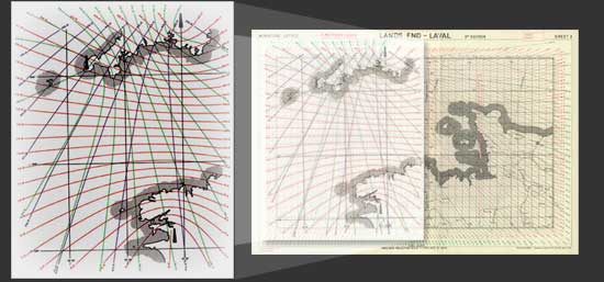 |
| RADAR NAVIGATION By using more than one radar "pulse", aircrews could navigate without referring to the stars or to familiar landmarks. By reading input from three widely separated pulse transmitters, which provided grid lines over a map of the ground, air navigators could plot their flight path and current position. |
|
|
Image 3 of 26 |
|