Maps
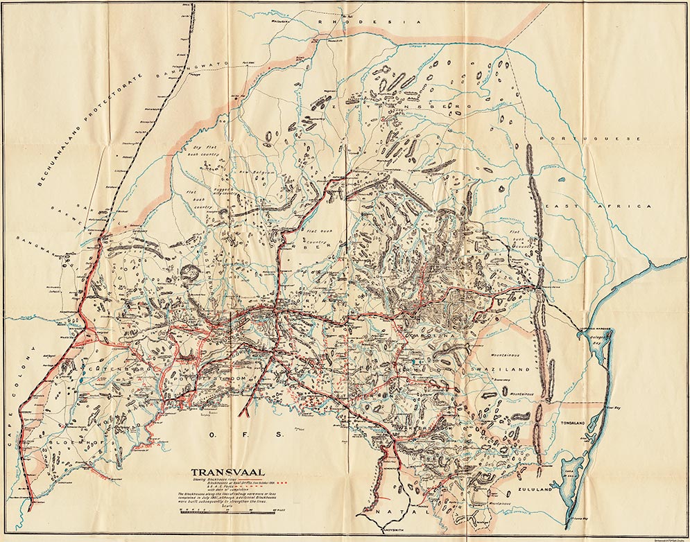
Map of the Boer Republic of Transvaal Showing Blockhouse Lines and South African Constabulary Posts with Dates of Completion
Click to view with Interactive pan & zoom (2.5Mb *Flash Player Required)
Click to view with Interactive pan & zoom (2.5Mb *Flash Player Required)