Canada's Naval History
www.warmuseum.ca/navalhistoryCanadian War Museum

This section brings together the approximately 700 objects and photographs used in Canada's Naval History. Use this section to directly access objects and photographs grouped by type, as shown below, or use the search function above to search through them by title.
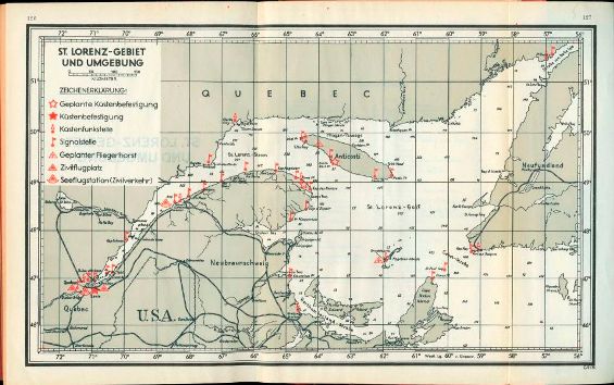
German Map of the St. Lawrence
This 1943 map, providing a general overview of the River and Gulf of St. Lawrence, formed part of a German U-Boat (submarine) navigation handbook.
The legend at the upper left identifies locations including navigation lights and lighthouses (Signalstelle), coastal radio stations (Küstenfunkstelle) and facilities that could help a U-Boat determine its location. It also identifies threats like coastal defence batteries (Küstenbefestigung) and civilian airfields that could serve as bases for Allied military aircraft (Zivilflugplatz).
George Metcalf Archival Collection
CWM 19730174-002_b