| Canadian History of RADAR |
|
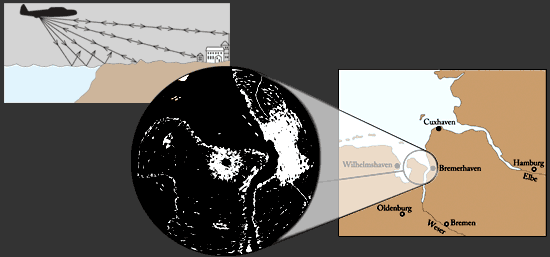
| SURVEILLANCE RADAR Flying aircraft can map the earth beneath them by using surveillance radar. In the images that these radars produce, areas of water appear black, while land and urban areas appear in different shades of white. During the Second World War, such radars helped guide Allied bomber crews to their targets. The German port city of Bremerhaven, shown here, was familiar to navigators of many Allied bombers. |
|
|
Image 6 of 26 |
|