
Maps
Maps of South Africa
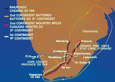
- Map of Southern Africa Showing the British Colonies and the Boer Republics
- Map of the Boer Republic of Transvaal Showing Blockhouse Lines and South African Constabulary Posts with Dates of Completion
- Map of the Boer Republic of Orange Free State Showing Blockhouse Lines and South African Constabulary Posts with Dates of Completion
South African War Battle Maps
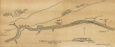
- Map of the Battle of Paardeberg Showing the Position of the IX Division on 18 February 1900 during the First Engagement
- Map of the Battle of Paardeberg Showing the Position of the XIX Brigade on 20 February 1900
- Map of the Battle of Paardeberg Showing the Area of General Pieter Arnoldus Cronje's Laager and the Position of the XIX Brigade on the Morning of 27 February 1900 when General Cronje's forces surrendered
- Map of the Battle of Doornkop, 29 May 1900
- Map of the Battle of Faber's Put, 30 May 1900
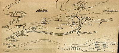
- Map of the Battle of leliefontein, 9 a.m., 7 November 1900
- Map of the Battle of leliefontein, 11 a.m., 7 November 1900
Maps Indicating the Movement of Canadian Units during the South African War
- Map of South Africa Indicating the Line of March of the Canadian Contingents
- Map Indicating the Movement of the Royal Canadian Dragoons and 1st Canadian Mounted Rifles, 9 April - 6 June 1900
- Map Indicating the Movement of the Strathcona's Horse, 20 June - 1 September 1900
- Map Indicating the Movement of the 2nd Canadian Mounted Rifles, 19 March - 16 June 1902
Maps of South Africa
Map of Southern Africa Showing the British Colonies and the Boer Republics
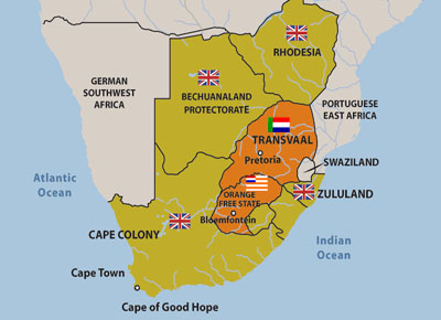
Click to enlarge: [Large
755 X 508] (28Kb)
Map of the Boer Republic of Transvaal Showing Blockhouse Lines and South African Constabulary Posts with Dates of Completion
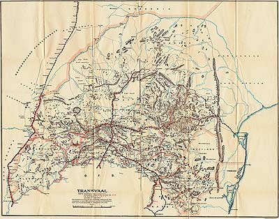
Click to enlarge: [Large
995 X 782] (230Kb) [Interactive
pan & zoom] (2.5Mb *Flash Player Required)
Map of the Boer Republic of Orange Free State Showing Blockhouse Lines and South African Constabulary Posts with Dates of Completion
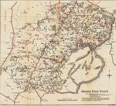
Click to enlarge: [Medium
995 X 916] (270Kb) [Large
1550 X 1427] (491Kb) [Interactive
pan & zoom] (1.16Mb *Flash Player Required)
South African War Battle Maps
Map of the Battle of Paardeberg Showing the Position of the IX Division (which included the 2nd Royal Canadian Regiment) on 18 February 1900 during the First Engagement
Click to enlarge: [Medium
995 X 448] (122Kb) [Large
1550 X 698] (247Kb)
Map of the Battle of Paardeberg Showing the Position of the XIX Brigade on 20 February 1900
Click to enlarge: [Medium
995 X 408] (89Kb) [Large
1550 X 635] (224Kb)
Map of the Battle of Paardeberg Showing the Area of General Pieter Arnoldus Cronje's Laager and the Position of the XIX Brigade Including the Royal Canadian Regiment on the Morning of 27 February 1900 when General Cronje's forces surrendered
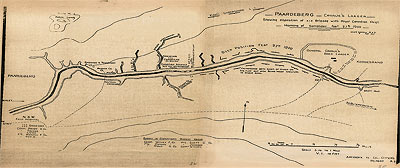
Click to enlarge: [Medium
995 X 419] (109Kb) [Large
1550 X 652] (214Kb)
Map of the Battle of Doornkop, 29 May 1900
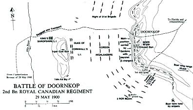
Click to enlarge: [Large
988 X 559] (83Kb)
Map of the Battle of Faber's Put, 30 May 1900
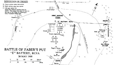
Click to enlarge: [Large
983 X 550] (84Kb)
Map of the Battle of Leliefontein, 9 a.m., 7 November 1900
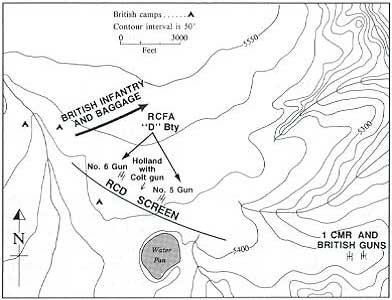
Click to enlarge: [Large
585 X 481] (71Kb)
Map of the Battle of Leliefontein, 11 a.m., 11 November 1900
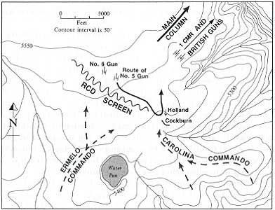
Click to enlarge: [Large
585 X 481] (80Kb)
Maps Indicating the Movement of Canadian Units during the South African War
Map of South Africa Indicating the Line of March of the Canadian Contingents
Map Indicating the Movement of the Royal Canadian Dragoons and 1st Canadian Mounted Rifles, 9 April - 6 June 1900
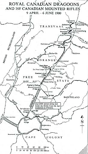
Click to enlarge: [Large
418 X 736] (81Kb)
Map Indicating the Movement of the Strathcona's Horse, 20 June - 1 September 1900
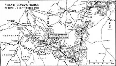
Click to enlarge: [Large
983 X 553] (124Kb)
Map Indicating the Movement of the 2nd Canadian Mounted Rifles, 19 March - 16 June 1902
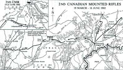
Click to enlarge: [Large
994 X 560] (132Kb)